landblink

A flight instrument for the window seat.

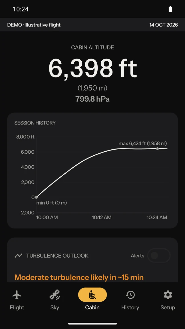
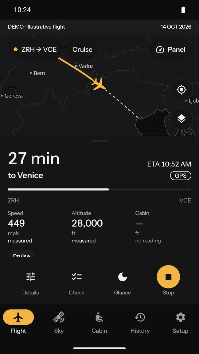
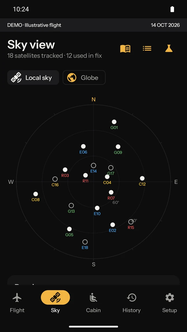
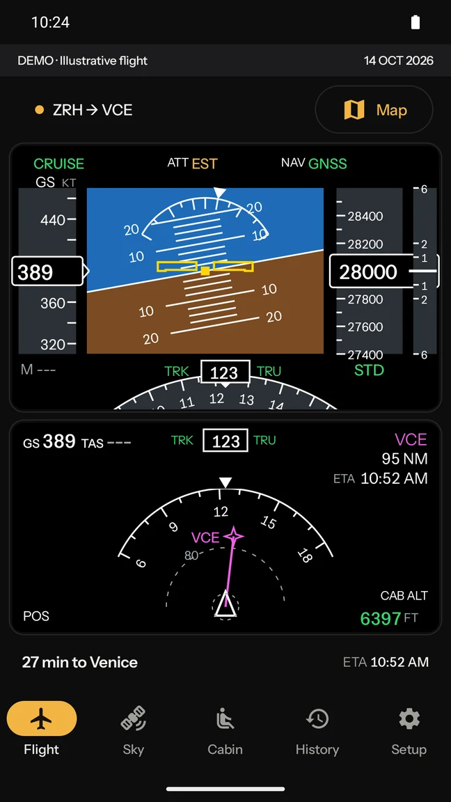
Your speed, altitude and position on a moving map, worked out by the phone in your hand from the satellites above it — with no network at all. And afterwards, the flight, kept.

Download for Android See a real flight

Android 10 or newer · 24 MB · direct download, not on Google Play

land-
blink

n. — a yellowish glow on the underside of cloud, thrown up by snow-covered land still below the horizon.

Merriam-Webster

Sailors read it to know land was there before they could see it. This app does the same job from a window seat: it reads the sky to work out where the ground is, and it does not ask anyone for the answer.

A flight this app recorded

6H173 · Tel Aviv to Tivat

Not a mockup. 4,000 positions stored by the app on 25 July 2026, drawn here from the recording itself — and published on the same terms it would publish yours, which is why both ends stop short.

32°N34°N36°N38°N40°N42°N19°E23°E27°E31°E TLV TIV
ALTITUDE, ALONG THE SHARED TRACK11,643 m
Shared — 3,624 positions Withheld — 59 at the start, 317 at the end
1,917KILOMETRES FLOWN
2h 41mIN THE AIR
11,646METRES, HIGHEST
478KNOTS, FASTEST

What it does

The live instrument

Speed, altitude, heading, and where you are

A moving map with groundspeed, altitude, heading, distance flown, distance to go and an arrival time — all of it computed on the phone, updating as you fly.

No network needed

It works in airplane mode, over the ocean

The map, the airport table, the city gazetteer and the satellite catalogue are all inside the app. Nothing is fetched in flight, because there is nothing to fetch.

It does its own maths

A position solved from raw satellite signals

Rather than only asking Android where it is, Landblink can compute its own fix from raw satellite measurements, with a least-squares solver and an inertial bridge across gaps. The Nav Lab screen shows that working.

The flight you keep

A record worth having afterwards

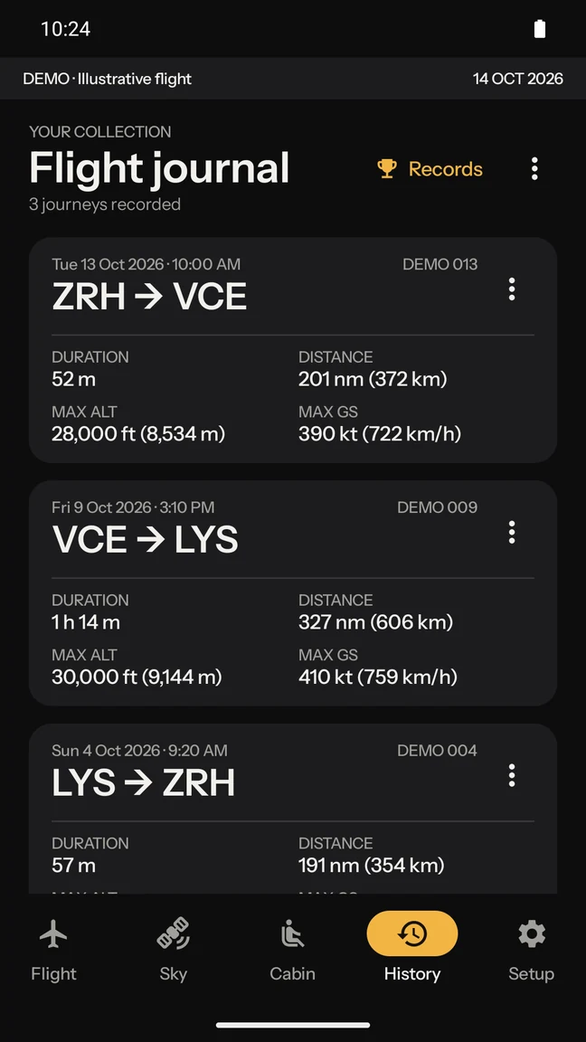
The track on a map, altitude and speed profiles, cabin pressure, the places you flew over, a replay you can scrub through, personal records, and a GPX file that is yours.

What it will not do

It tells you when it is guessing.

An instrument earns trust by saying what it does not know. When the satellites drop out and the position is carried forward by dead reckoning, it is labelled dead-reckoned — not quietly drawn as if it were measured. Turbulence is called an estimate, because it comes from forecast wind and not from felt bumps.

There is exactly one rule underneath all of it: an uncertain answer is never dressed as a certain one. Everything else in the app is downstream of that.

TLV → TIV

over Holon · 57 km W of Jaffa

GS486 kt
ALT38,000 ft
HDG284°
MEASURED FIXESTIMATED

Your flights

Recordings stay on the phone.

Sharing a flight, so it can improve the crowd-built route predictions, is opt-in and off by default. When you do share one, the airport ends of the track are withheld: everything within 15 km of where the recording started and ended stays on your phone, so the stand, the taxi route and the touchdown position never leave it.

Positions are removed, never nudged. A shared point is always a real measurement — there are simply fewer of them.

On the flight above that came to 59 positions withheld at Tel Aviv and 317 at Tivat — the taxi, the climb-out and the whole approach — leaving 3,624 of 4,000 to share.

Read the full privacy policy

What it is not

Install

A direct download.

Landblink is not on Google Play yet. You download the file and install it yourself, which Android calls sideloading and will ask you to confirm.

  1. Download the APK on the phone itself, using the button below.
  2. Open it from your notifications or your Downloads folder.
  3. Allow the install when Android asks whether to trust this source. You can turn that permission straight back off afterwards.
  4. Grant location when the app asks. It is used in the foreground only, while the app is open or recording.
RequiresAndroid 10 or newer
Size24 MB
Devicesarm64 phones
CostsNothing, and no account